NS4375 : Path near Greenland Farm
taken 14 years ago, near to Milton, West Dunbartonshire, Scotland
This is 1 of 10 images, with title Path near Greenland Farm in this square
Path near Greenland Farm
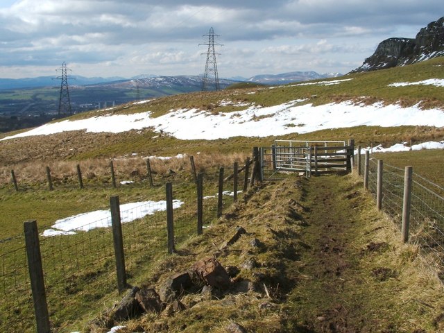
At the end of the section shown in NS4375 : Path near Greenland Farm, the footpath turns left, at the point shown here, and resumes its downhill course; see NS4375 : Path near Greenland Farm.
For a view back from just beyond the gate, see NS4375 : Path near Greenland Farm.
For a view back from just beyond the gate, see NS4375 : Path near Greenland Farm.
Path near Greenland Farm
The area near Greenland Farm had been the subject of protracted negotiations to secure public land access, as specified by the Land Reform (Scotland) Act 2003. The situation was resolved by the creation of a path, bounded by two fences, for the use of pedestrians and cyclists; it now forms part of the Crags Circular Path, a much longer route.
![Creative Commons Licence [Some Rights Reserved]](https://s1.geograph.org.uk/img/somerights20.gif)
|
· Find out How to reuse this image ·
Share:
|
|||||
| Start a discussion on NS4375 | Suggest an update to this image | Contact the contributor | |||
 Map © Crown Copyright")
TIP: Click the map for more Large scale mapping
- Grid Square
- NS4375, 60 images (more nearby
 )
)
- Photographer
- Lairich Rig (find more nearby)
- Date Taken
- Friday, 2 April, 2010 (more nearby)
- Submitted
- Friday, 9 April, 2010
- Geographical Context
- Near (from Tags)
- Category
- Footpath (more nearby)
- Subject Location
-
OSGB36:
 NS 4357 7548 [10m precision]
WGS84: 55:56.8091N 4:30.3928W - Camera Location
-
OSGB36: NS 4359 7546
- View Direction
- Northwest (about 315 degrees)
Looking for a postcode? Try this page
Other Tags
Image classification(about):
Geograph
This page has been viewed about 133 times.
View this location:
KML (Google Earth) ·
Google Maps ·
Bing Maps ·
Geograph Coverage Map ·
More Links for this image